Forgotten Town of Thornton Gore, New Hampshire

| Date: | 10-14-2023 |
| Location: | Thornton, NH |
| Distance: | 5.53 mi |
| Elevation Gain: | 458′ |
| Total Time: | 4 hr 15 min |
| Parking: | 4 cars |

Thornton Gore is an old forgotten town in the White Mountains of New Hampshire. It was once a thriving community of farmers who lived and farmed land in a mountain landscape. The town existed for about 100 years before it could no longer sustain itself.
Now the town is slowly being taken back by the forest. But there are still lots of signs of this community still visible. My friend Melissa and I set out to see what we could find.

From everything I’ve read it seems there are two ways to access the town. The first was from the south, through Throntons Gore Road. However, most of the people who explore this old town enter from the north at Tripoli Road. This is where we decided to start from.
We parked just past the Ranger station near the directional sign. There was room for three or four cars along the side of the road. There are also other spots to park further down.

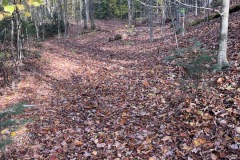
This road used to be the main road between Thornton Gore and the town of Woodstock. Now it’s not much more than a wide foot path. The trail starts to gradually drop in elevation. We came across a campsite and an old apple orchard.

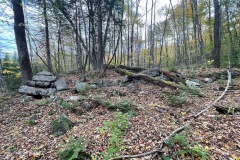
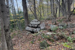
Shortly after that we found our first cellar hole. According to an old detail from a 1892 map of the Gore we had, it was the home of F. Marden. We walked around the cellar and took some pictures.
A little further down the road we came across the Wildcat Cemetery. Many of the people in this cemetery were former veterans. Some may have even served in the Civil war. Many of the veterans had flags by their gravestone. The whole cemetery was well taken care of.

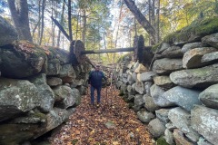
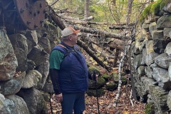
After the cemetery the road is lined with well-preserved stone walls. There is a split that appears like an old train track or road that led us to the site of the Saw Mill on the Talford Brook.
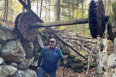
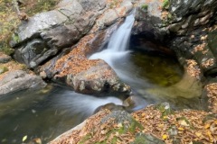
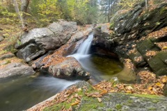
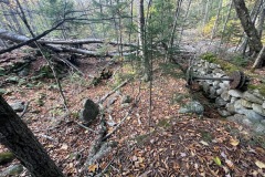
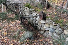
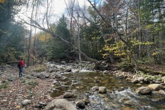
This was a cool site. The foundations to the mill were in great condition. It even had an old axel to what must have been a water wheel. Upstream there was a nice water fall that was worth checking out. Lots of photos taken here.


We continued along down to the Eastman Brook. It seems like there was once a bridge that spanned the brook but not anymore. We decided to stay on this side of the brook for now and headed west to explore some cellars there.
We ended running into some folks from the Forest Dept. that were out surveying. We decided to let them do their thing and not bother them. We backtracked to the brook crossing.

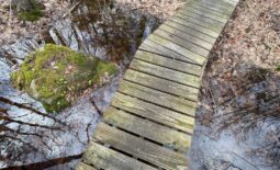
Crossing the Eastman brook was a bit challenging if you wanted to keep your dry feet. We both made it across successfully and without injury. After we climbed up the embankment there was an off shoot trail to the east.
Our maps said this would take us to the old J. Parker home and the J. Elliot home. The trail started out fine and had a slow gradual incline. Soon the trail widened, and you could see it more as a road with stone walls on both sides.

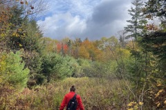
Several areas were very overgrown with what looked like Poison Ivy. So I made sure to watch my step. A good portion of this trail was also very wet and muddy. Lots of small water crossings. There were signs of Moose walking in the mud and even a few beds they may have lied in.

These cellars were a bit further down the trail then we thought. Eventually we made it to the Parker house. There was a small pond that caught our attention too. The Parker foundation was in pretty good shape. We also found a well on their property.


We continued up to a short logging road that was really muddy and mucky. Not much down there except for trees marked to be logged. We decided to start heading back and skipped the Elliot house.

On the way back we took what looked like a road on my Gaia app but it was more of a bushwhack following a stone wall. When we got back to the main trail we continued south and found some other town sights.
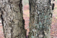
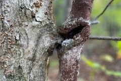
The next site we found was the old church. This was identified by the brick that was grown in the birch tree. We were hoping to find this marker but were not quite sure where to look. Sometimes it’s good to be lucky. We found a few other cellars near buy as well.


We were both getting hungry and started to make our way back to the car. On our way out we again had to carefully make our way across the water crossing.

On the way out we stopped at the D. Dearborn home that we had missed on the way in. This cellar was right next to a camp site we saw but missed the cellar.


We spent a little over 4 hours exploring the town. There is still a lot more that we didn’t see, and I look forward to coming back and visiting again. There is a lot of history in these woods, and it is great to be able to visit them.

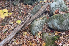
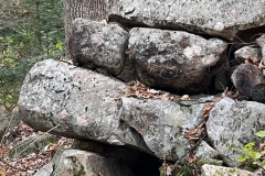
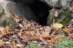
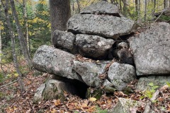
This post has a lot of photos. More than most of my trip reports. That is because I wanted to document the area and the condition of the cellars. I also wanted to show off the craftsman ship that went into building some of the cellars. Of Course we were careful not to disturb any artifacts we came across.







October 19, 2023 @ 10:55 am
This was so interesting, thank you I can’t wit to visit and explore
October 19, 2023 @ 1:10 pm
Very cool! Thanks for sharing the info.
October 20, 2023 @ 12:17 am
I have been going to Millbroo k Rd since I was 6 years old. We recently sold the camp and I miss it. What road is Thornton gore off of or on.
October 21, 2023 @ 2:51 pm
it’s a beatutiful area!
October 21, 2023 @ 8:43 am
This is a very interesting article! The old cemetery is particularly interesting.
October 21, 2023 @ 10:46 am
In the old orchard where there any signs of fruit? I heard there is now a hard cider operation in the town of Thornton called Crucial 10.
October 21, 2023 @ 2:50 pm
I saw what looked like two apple trees still standing but they looked very dead.