Haunted Hike to Indian Arrowhead Rock

| Date: | 10-23-2024 |
| Location: | Surry, NH |
| Distance: | 2.39 mi |
| Elevation Gain: | 407′ |
| Total Time: | 1 hr 59 min |
| Parking: | 1-2 cars |
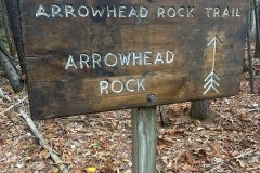
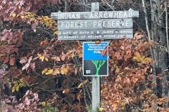
The last stop on our trip is Indian Arrowhead Rock. This is a two mile hike up to the top of the mountain where there is a carving of a bow and arrow.

We found the trail head on the side of the road. There is no real parking but there is plenty of room to pull off. So that is what we did. After we got our packs on, we started up the leaf covered path.
By the time we got to the spit where we would loop back, we could tell that this trail had not been maintained in a while. We deiced to do the loop clockwise and to go up the steeper grade.

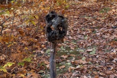
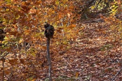
Soon after the junction we came upon a sick stuck in the middle of the trail with a piece of a tree on top that looked kind of like a skull. Creepy, yes. Was it a little foreshadowing for the hike ahead, also yes.
We took a few pics of this artwork and continued for a few minutes. As we are walking, we hear a large loud crack, like a tree was about to come down. Then a big branch falls about 60 feet in front of us and large tree truck is caught up in the tree shaking.


It turns out the tree had already fallen, but the trunk just happened to break again, just after the creepy skull…coincidentally. We talked for a minute about what happened then continued on.
At this point the trail starts to climb a little steeper and there are a lot of acorns to slip on. After a bit of climbing, we made it to the summit and found the rock with the carvings.

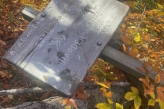
The carving was first believed to be a native American marking of a bow and arrow pulled back and pointing toward Keen, NH and Mt. Monadnock. It was later discovered that a local man named William Mason was the creator of the marks. Mr. Mason was an interesting person.
When we got there, the rock was covered with pine needles and leaves so we cleared it of as best as we could. We looked at if from all kinds of angles and couldn’t quite make out the bow and arrow.


There were lots of lines carved and it looked like some erosion or vandalism may had occurred. So I’ve also linked some other images of what the rocked looked like in the past.

After a bit of time looking at the rock we decided to move along and continue around the loop. There were other cellars, wagon wheels and foundations to find according to the Haunted Hikes book.
The area is also known for having gold, silver, copper and other minerals in it. In the late 1700’s many people moved here to find a fortune. By 1800 the town dried up. Just a few people left. One of these people was William Ritter. He stayed till his death in 1827.

Legend has it this forest is haunted by an old prospector by the name of William Ritter. So if you find any gold or silver you better hide it or Olé Will Ritter might steal it!
We didn’t find any gold or see Will Ritter but we did have the skull and tree incident earlier so we were good. We did find some old cellars and stone walls along our way. We explored them a bit. We did not find any old graves or the wagon wheel.

This last part of the route was a bit overgrown and had lots of blowdowns. Lots of up and over, under and around. It was not long before we made it back to the beginning of the loop and back to the car.
This hike was a bit out of the way but still worth doing at least once. One thing for sure is it will always be a haunted hike in my book!

