First XC Ski of the Season – Tripoli Road

| Date: | 11-29-2024 |
| Location: | North Woodstock, NH |
| Distance: | 4.18 mi |
| Elevation Gain: | 312′ |
| Total Time: | 2 hr 29 min |
| Parking: | 10+ cars |
Twas the day after Thanksgiving. Since some areas of the state got a good amount of snow on Thanksgiving, I deiced to take my XC Skis out and find some of it.

Since I was going by myself I choose to go up part of Tripoli Road off of exit 31. When I got to the gate, there were a couple other vehicles there. Plenty of room to park, just don’t block the gate.
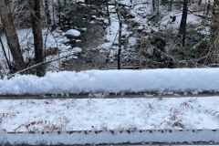
I got my boots and skis on and started out. The temp said it was in the mid 30s. Right at the beginning the snow was thin and very scratchy. I was looking at the incline and wondering if this might be too fast for my first time out.

The road started out with a large broken tree I had to ski under and then passes by several climbing cliffs to the left. The road climbs softly for about a quarter mile.
Then it gets a little steeper but still manageable. Some areas of the road were very thin, especially under dripping trees. I arrived at the White Mountain National Forest sign shortly after.

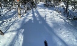
From the sign the road flattens out for a while. There were some these spots where I could see the road and almost had to take the skis off. Other areas were about 2-3” deep. A lot had to do with how the wind blows and what parts of the road are exposed to sun.

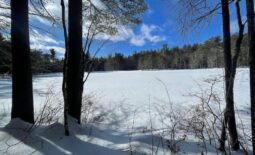
I skied for a bit before I reached the Russell Pond Sign and the road up to the campground. Not far from here is the ranger station. It has a cool Birch tree awning covering the doorway.

Next the incline looked to get a little steeper, but I wanted to reach the junction to Thorntons Gore Road and that was at the top of the next little climb. Once up there I wanted to see if I could find the Old Road on the north side of the road but was unsuccessful.

I skied back along a small side trail/road that took me to the hill by the ranger station. The snow was starting to loosen up a bit. Now that it was not pure ice, it made for a better ski down.
Once I got back over the flat section, I started skiing down cautiously. I did encounter one area that was too thin to ski, but overall it was a fun ride down.

It’s always a good day when you can get your xc skis out in November. Can’t wait for more snow.


